STEP FOUR – Entering Detailed Water Data
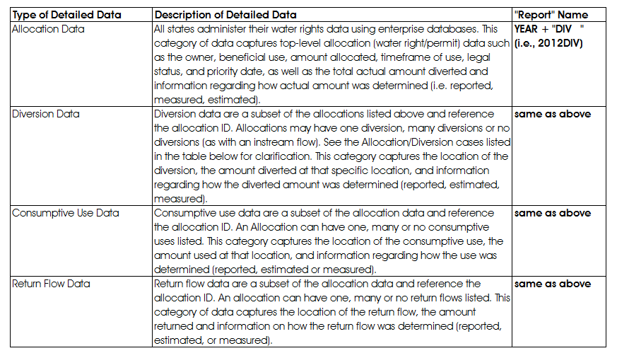
Assess what type of detailed water data your organization oversees. This may be housed by a different agency in your state, in which case, you can proceed to Step Four – Configuring Access for WaDE user. The WaDE schema can accommodate four different types of detailed data: Water Allocations, Water Diversions, Consumptive Use and Return Flows. See the table below for a description of each and the type of ‘Report’ that is used to access it.
Geospatial Data
If you have geospatial data related to either your Summary or Detailed data, you may send the layers to Sara so that she can set them up as Web Feature Services (WFS) on ArcGIS online (AGOL), or stand them up from your own geo-server or using AGOL. Use the WFS address in the WADE.GEOSPATIAL_REF table for each GIS file you’d like to share. All of the DETAIL and SUMMARY tables have a column called “WFS_FEATURE_REF” that can be used to tie the individual estimate back to the correct shape in the identified WFS. This is a way to provide GIS data alongside each estimate, but not slow down the query results with larger XML/geoJSON/JSON data retrievals.
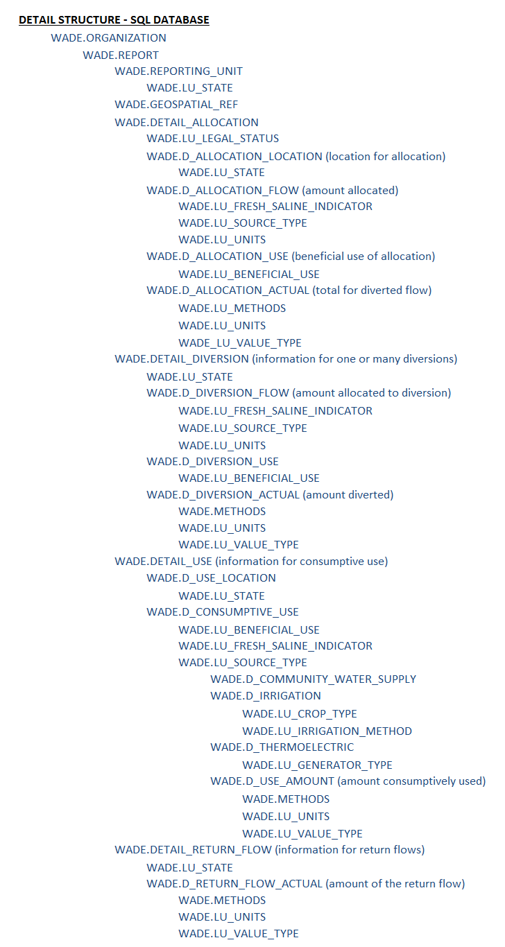
Follow the sequence in the table below to view both the hierarchy of main summary tables and the secondary, look-up, and methods tables. It is recommended that you proceed to fill out the data in this order, updating the look-up and methods tables as you proceed through the detailed datasets. Use the sample data as a guide.
When all of your WaDE tables have been populated, evaluate how often you would like to update different types of information. Set up automatic scripting to update (append) the tables with new information that will be included in the WaDE reports. The “Reporting_Date” column should be updated with the new date. You are now ready to start “flowing” your data using web services.