Western State Water Resources Agency
Use of Cloud Computing Technology & Platforms – October 2018
A Joint Investigation between the Western States Water Council and NASA’s Western Water Applications Office (WWAO)
![]()
![]() The ability to acquire, process, maintain, and publish data and metadata related to water resource management is a critical and foundational activity that supports administration and planning by western water resource agencies. Projects, models and the array of observations related to hydrology and watershed dynamics are rapidly increasing in complexity, spatial, and temporal scale. They are also increasing in computational requirements due to the exponential proliferation of sensor-based data, the availability of free and low-cost remote-sensing imagery, and the variety of parameters that can now be brought into the modeling process.
The ability to acquire, process, maintain, and publish data and metadata related to water resource management is a critical and foundational activity that supports administration and planning by western water resource agencies. Projects, models and the array of observations related to hydrology and watershed dynamics are rapidly increasing in complexity, spatial, and temporal scale. They are also increasing in computational requirements due to the exponential proliferation of sensor-based data, the availability of free and low-cost remote-sensing imagery, and the variety of parameters that can now be brought into the modeling process.
There is a growing need to understand how states and local water resource agencies can effectively use cloud computing resources to sustain the new tools and capabilities offered by WSWC and NASA ASP/WWAO research teams. Both organizations have a strong interest in 1) understanding existing policies and guidelines on use of cloud computing resources; 2) identifying barriers to development or implementation of these policies; and 3) identifying best practices and case studies that could inform and accelerate adoption of cloud computing resources to enhance and sustain newly developed services and tools. Via a survey, a targeted workshop (WIMS – see below), and the summary report shared here, WSWC and NASA’s ASP/WWAO have reviewed the policies and organizational constraints within western state water agencies that may tilt the scale for, or against, cloud solutions. Several case studies of agencies’ experiences with the cloud illustrate its benefits and reveal its challenges and remaining barriers.
***Support for this report and the WIMS workshop was provided by NASA’s Western Water Applications Office. WSWC wishes to express its gratitude to WWAO team members for their involvement and contributions to the survey, this report, and for graciously co-hosting the WIMS workshop at the Jet Propulsion Laboratory campus.***
For the full report, click here.
For the Executive Summary, click here.
WSWC and the NASA’s ASP/WWAO team will continue to investigate what platforms and financial arrangements work well for their members and project co-sponsors. They will continue to work with project partners and co-sponsors to identify streamlined strategies to support their long-term data management needs. This may include governance bodies and partnerships that share in the benefits and costs when hosting and processing large datasets in a cloud environment.
_________________________________________________________
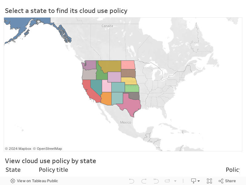
Western State Cloud Computing Policies (as of October 2018)
________________________________________________________
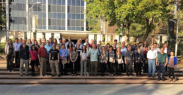
Water Information Management Systems (WIMS) Workshop – January 2018
Thank you for coming!
Workshop Goals: WSWC is re-introducing the WIMS to increase dialogue between not only member state appointees, but among their IT and program staff also. The intent is to discover the needs of WSWC members and their highest priorities regarding water data acquisition, quality control, and publication. Jointly hosted by WSWC and NASA’s Western Water Applications Office (WWAO), this WIMS focuses on water use reporting/permitting systems, IT-related adjudications topics, use of cloud computing and big data, an overview of advances and recent projects pertaining to remote-sensing techniques with participation from NASA’s WWAO office, and open water data platforms and trends. Future WIMS topics will also be discussed.
To all attendees, we hope that this workshop was fun and informative. Thanks to your feedback, the next WIMS will be even better!
MEETING MATERIALS:
- NEW! WIMS Workshop Summary
- 2018 WIMS Workshop Agenda
- Updated WIMS Attendee List
- NEW!! Flickr Album for the WIMS. Please email your favorite photos to Sara (saralarsen (at) wswc.utah.gov) and she’ll add them to the Flickr Album.
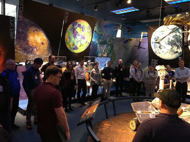
Click on the arrows on the sides of the photo to see more.
PRESENTATIONS:
January 16, 2018
Water Rights/Adjudications Data Management Strategies
Welcoming Remarks – Tony Willardson, WSWC Executive Director
How Oregon Uses the National Hydrologic Dataset (NHD) to Route Water Rights – Ken Smith, Oregon Water Resources Department
Data Management Tools for Adjudications in Utah – Jim Reese, Technical Services, Utah Division of Water Rights
Survey 123 and Field Water Survey Tools – Linda Davis, Water Resource Information Section Manager, Idaho Dept of Water Resources
Unmanned Aerial Ssystem Use in Adjudication Verification – Katherine Mellon, Professional Engineer, Nevada Division of Water Resources
Water Use/Permitting Data and Reporting Systems
Improving Online Water Use Reporting in Utah – Jim Reese, Technical Services, Utah Division of Water Rights
Online Water Use Reporting in Arizona – Lisa Williams, Arizona Dept. of Water Resources
Nebraska DEQ Online Permits and Information Sharing – Dennis Burling, Deputy Director Administration, Nebraska Dept of Environmental Quality
Method and Data for Developing Projections for Water Plans – Yun Cho, Manager, Texas Water Development Board
Implementing the Sustainable Groundwater Management Act in CA – Steven Springhorn, Senior Engineering Geologist, California Dept of Water Resources
January 17, 2018
“Big Data” and the Cloud
States’ Use of Cloud Computing Survey and the WaDE Program – Sara Larsen, WaDE Program Manager, WSWC
NASA Science Mission Directorate – Applied Sciences Program – Mark Davidson, WWAO Program/Application Transition, NASA (Applied Sciences Website)
TWDB and the Cloud: Sunny Days and One Big Storm – Sam Hermitte, Interim Deputy Executive Administrator, Texas Water Development Board
Evapotranspiration Estimates and Tools – Ben Britton, Systems Programmer, Idaho Dept of Water Resources
Advances in Remote Sensing of Water Resources
CIMIS and NASA’s SIMS: Applications of Satellite Data to Support Improved Irrigation Management in California – Forrest Melton, Senior Research Scientist, NASA ARC-CREST (SIMS webpage)
NASA and DRI – The Open ET Project – Justin Huntington, Associate Research Professor, Desert Research Institute
MODIS Snow Products and Estimating SWE in Wyoming’s Mountain Ranges – Beth Callaway, River Basin Coordinator, Wyoming State Engineer’s Office
InSAR Land Subsidence Monitoring – Tom Farr, Geologist, Jet Propulsion Laboratory, NASA
Remote Sensing for Water Quality Monitoring – Christine Lee, Research Scientist, Jet Propulsion Laboratory, NASA
NASA Soil Moisture Active Passive (SMAP) Satellite – Raha Hakimdavar (for John Bolten), Research Scientist, Goddard Space Flight Center, NASA
Lunch Presentations
Improving S2S Precipitation Forecasting for Water Resources Management – Jeanine Jones, Interstate Resources Manager, California Dept of Water Resources
Use of Sub-seasonal to Seasonal (S2S) Rainfall Forecasts by TWDB – Nelun Fernando, Hydrologist, Texas Water Development Board
Breakout Brainstorming Sessions
Breakout Questions
Group 1 Answers
Group 2 Answers
Group 3 Answers
Group 4 Answers
Federal Data Sources, Methods, and Applications
Water Availability and Use Science and WUDR Programs – Mindi Dalton, Deputy Director, WMA Office of Planning and Programming, U.S. Geological Survey (WUDR webpage)
Referencing Data to the NHD and the Power of an Intelligent Stream Network – Drew Decker, National Map Liaison, U.S. Geological Survey
Agrimet Weather Station Network Updates – Jama Hamel, U.S. Bureau of Reclamation
USBR Regional Water Information System (RWIS) and the Data Visualization Challenge – Allison Danner, U.S. Bureau of Reclamation (RWIS webpage)
The National Integrated Drought Information System (NIDIS) – Amanda Sheffield, Regional Drought Information Coordinator (NIDIS webpage)
January 18, 2018
Data Access, Publication, Visualization, and Archiving
Internet of Water – Sharing and Integrating Water Data for Sustainability – Lauren Patterson, Senior Water Policy/Associate, Duke University (IOW report and website)
CUAHSI Water Data Services – Jerad Bales, Executive Director, Consortium of Universities for the Advancement of Hydrologic Science, Inc. (CUAHSI Data Services webpage)
Impact of Soil Moisture Probe Data on Agricultural Water Use – Jonathan Aguilar, Assistant Professor, Kansas State University
Unmanned Aerial Vehicle (UAV) Use in Water Project Operations and Maintenance – Gary Darling, Operations Research Specialist, California Dept. of Water Resources
CA Water Board Data Management Strategy and Open Data Initiative – Greg Gearheart, Deputy Director, Information Management and Analysis, California Water Resources Control Board
Introduction to the Groundwater Evaluation Toolbox – Brian Dunnigan, Olsson Associates
TWDB Data Visualization: Clear Information, Clear Benefits – Sam Hermitte, Interim Deputy Executive Administrator, Texas Water Development Board
WSWC’s WaDE Program Status, the API, and Program Directions – Sara Larsen, WaDE Program Manager, WSWC (WaDE website)
OWIA (AB1755) and Western Water Data Archive – Gary Darling, Operations Research Specialist, California Dept. of Water Resources (AB1755 docs)
Leveraging Open Source to Minimize Risks with Development and Maintenance – Chris Bader, Manager Information Systems, North Dakota State Water Commission[/fusion_builder_column][/fusion_builder_row][/fusion_builder_container]